Chóra - Moni Chozoviótissa - Asfondilítis - Egiáli |
|||
|
Evaluation: This
is definitely one of the most fabulous hikes on Amorgós. You follow the spine of
the island, you get to know the marvellous Chozoviótissa-monastery, you discover
some unique landscapes and you finally arrive at the pleasant bay of Egiáli,
where you can have a swim. This hike obviously gets the maximum evaluation of
****. Estimated time:
The actual hiking time (AWT) takes
about 4h20 for the total distance of 13,5
km, so it is necessary to
depart fairly early – for example by taking the bus from Katápola to Chóra at
about 9am. It is advisable to visit the monastery before the arrival of the
majority of the tourists, so around 10am at the latest. You can then picnic
after having been hiking for about two hours, close to the deserted village of
Asfondilítis. You will thus get to Egiáli at about 4pm which means that you
still have time for some relaxing hours at the beach. You can take your evening
dinner in one of the taverns at the harbour and you can return to Katápola with
the evening bus (about 45 minutes) or with the Express Skopelítis (about 1
hour). Route
description:
(0h00) From the bus stop at the entrance to Chóra you leisurely walk to the
other side of the village, via the Mési, the main street. (0h10) On the right side of the big square, you find a sign pointing to the right to the monastery, but first you should definitely admire the marvellous view on the large open spot in front of you. To the right and behind a metal gate, starts the marvellous descent to the monastery (hiking sign).
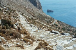
For 15 minutes you now follow the magnificent staircase going down, high above the sea.
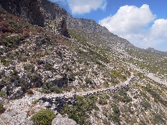
The monopáti that goes down from Chóra to Chozoviótissa.
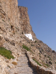
The staircase leading
to the monastery.
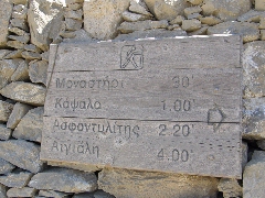
The monastery of the Panagia Chozoviótissa. (0h41) When leaving the monastery, you can now start with the actual hike. You go through the metal gate (hiking sign Asfondilítis 1h50 / Egiáli 3h30 and [1]). A staircase takes you up even higher, along the rocks and after 5 minutes you arrive at the top [1]; 2 minutes later, you get to a second gate [1] - for some minutes, the descent is difficult, because of the loose stones [1].
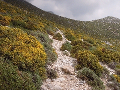
An obvious sign... You cross a big slope with loose
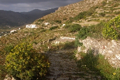
stones and then you get to a stretch between vegetation. The landscape is
impressive and the silence is overwhelming; high above you towers a huge cliff
and on the right you see the sea deep beneath. About 10 minutes after the
monastery, the path becomes easier and you climb now slowly. Along your path,
you see big red marks and signs…
The path is now easy and very clear. (0h59) Twenty minutes after the monastery you get to a kind of plateau, strewn with big white rocks and with remnants of stable walls – behind you, the highest top of the monastery is just disappearing.
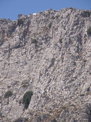
On the plateau... The impressive rock-face of the Profítis Ilías. You continue over the rocky and overgrown slope, going straight ahead all the
time (you pass a path off the left which leads to the Byzantine church of the
Panagia Theoskepastí and further on another path off the right to Agios Ioannis
Chrysóstomos - signs). You then go up towards the left on a stony path, in the
direction of the brown line through the landscape; this line is a stony road
which you reach after about 10 minutes.
(1h09)
You
follow this useless destruction of the landscape through an impressive and rocky
wilderness. Some 21 minutes later you reach a kind of saddle with the two coasts
of Amorgós both to the left and the right. There is a crossing of roads and also
a well. (1h29)
You should continue here to
the right (hiking sign Asfondilítis 55’ / Egiáli 2h40 and [1]): your trail runs
to the left of a stony road, with to the right the Xenodochio, the remnants of a
kind of medieval hotel on the road from Chóra to Egiáli. The trail zigzags
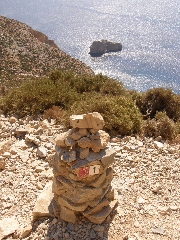
between the low vegetation and goes up for a little while - some large cairns
show you which way to go, and after 4-5 minutes, you again see a [1]. You walk
high above the modern road and you get a marvellous view on the carved north
coast and on the island of Nikouriá.
The brownish trail remains visible in front of you and continues almost
flatly. |
(1h45) You
get now to the highest point of your walk, at an altitude of about 420 meters,
with on the right the summit of the Kástellas (485 m) – the view on Nikouriá is
still fantastic; you see how the brownish trail continues to the next height. So
you go down, then you go up again and you find in front of you an impressive
valley: the path will now run around this valley. (2h01) When you get next to a big pale cairn, you arrive in front of
a shallow bowl-shaped valley; the trail continues far ahead, beside or between
crumbling walls. On your left you see passing a triangular summit, 460 meters
high. You thus arrive between walls, which further on diverge: you follow the
right wall. The walls converge and diverge again, and then you should follow the
left wall; in this way you arrive between some ruins, with a goat farm on the
left side. Until recently, this
"village" was totally abandoned, lonely on the rocky plateau. In recent years,
houses were built here and there, and a few houses are restored - there is even
a café to the left, which is open in Summer. The church has been restored too -
a little too much for our taste ...
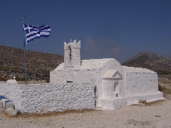
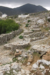
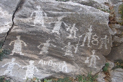
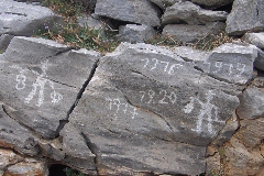
The little church of Asfondilítis. (2h39) Beyond the church, you continue straight - the road becomes a broad path. Pay attention: BEFORE the last of the eight wells you have to walk up to the left [1] - the path on the right descends to Chálara. Mind also the graffiti on the rocks on your left-hand side, at the beginning of the ascent. They are old, because you even notice dates like 1916 and 1920.
The wells in Asfondilítis.
Old graffiti in Asfondilítis. For many more minutes you now follow the marvellous trail: in front of you, you
can already distinguish the triangular top of the mountain, with on the left
side the stump of a mill – your path will pass on the left-hand side of this
hill.
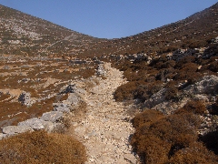
The splendid trail between Oxo Meriá and Agios Mámas. At the end, you obviously keep to the right between ruins [1], you first rise on
a stony path, later on on heavy steps, and so you arrive on the left of the
chapel. Again you notice the beautiful view over Nikouriá, especially in the
evening light.
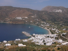
Panoramic view on Egiáli with (higher and to the right) Tholária. (3h26)
From now on you will only descend, first on a very stony path. You already can
see Tholária, then the pier of Egiáli appears, later also Langáda; behind you,
towards the left, you can see the sandy tongue of Agios Geórgios, in the narrow
strait that separates Amorgós from Nikouriá. You then descend for a long time on
an uneven paving or on steps - good shoes are quite useful again. On a stony
path you then descend in a side-valley and below you can see a well and some fig
trees.
The descent to Potamós.
(3h57) This
is Potamós, where you pass the nice Kamára cafe. You pass also a small chapel
and later on the parking lot. After 250 steps you reach Káto Potamós: at the
side-street, you take a right and down. You describe a curve to the left and
then you go right – in this way, you arrive at the main church, where you
descend to the right. [Pay attention:
recently, red signs and trail
markers [1] send you straight; in this way, the hike could continue to the right
of Egiáli and lead to the beautiful path towards Langáda...] On the right of the
harbour pier you find the bus stop and also a couple of restaurants. And more
importantly, the beach of Egiáli is a very pleasant place to spend some relaxing
hours. The bus trip takes about 45 minutes (there is one at 6pm), but in a
little office you can also buy tickets for the Express Skopelítis, the boat that
goes back to Katápola usually at 7.30pm. The boat trip through the narrow
channel in between the main land and Nikouriá is really worthwhile and in one
hour you are back in Katápola.
[If you want to make this
hike in the opposite direction, you have to depart from the harbour pier in
Egiáli and take the street which leads straight to Potamós. Over there you
follow the staircase which goes up to the church with the blue dome and then you
go higher and higher all the time.
To
get the printer-friendly version,
|
||
